Gustav Lindenthal really wanted to bridge the Hudson River. He was one of the most successful bridge engineers in the US – he’s best represented in New York by the Queensboro and Hell Gate Bridges – but nothing compares with his effort to building a suspension bridge across the Hudson. His work on this idea started in the 1880s and kept going into the 1920s, and took several forms, all of which had decks carrying heavy rail, ordinary vehicles, and pedestrians. The earlier versions, which would have hit Manhattan around 23rd Street, had a main span of 3100 feet, at a time when the recently-completed Brooklyn Bridge had the longest main span in the world at 1595 feet. The later versions moved it north to near 57th Street and had a slightly shorter main span. The later version, taken over by Othmar Ammann and the Port Authority, gradually turned into the George Washington Bridge.

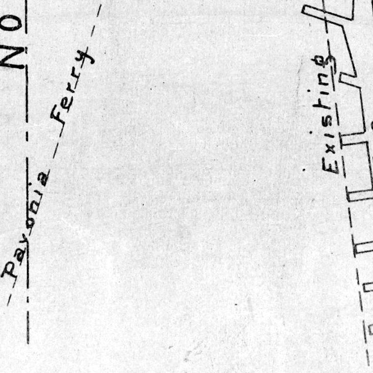
A few things to note: cities with docks – especially New York, based on its history of landfill – will keep extending piers further into the waterways if they can. The federal government sets the pier-head line, beyond which the waterway must remain clear. So the pier line is fixed, unlike most of the other geometry on this map. For people wondering what 13th Avenue could possibly be, it was the beginning of landfill further into the river than West Street. Most of the blocks between 13th and West were later removed to create usable piers, as those little stubs at the bottom of the map along 13th were pretty much useless as piers. As of 1891, the Hoboken waterfront had also not yet been landfilled to its current configuration. As a bridge was a potential obstruction of the navigable waterway, it had to be approved by the federal government, as represented by the Army Corps of Engineers.
I admire Lindenthal’s confidence in his proposed location. He’s oriented the map so that the proposed bridge line is perfectly horizontal, implying that it is not going to move in the slightest. This orientation is at odds with the street grid, and he started laying out the properties that would have to be condemned to run the bridge through the west side. That “new street to be opened” can be seen as the spiritual ancestor of Dyre Avenue, which basically exists to feed the Lincoln Tunnel.


You must be logged in to post a comment.