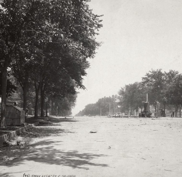
From the New York Public Library collection of images from the original Interborough subway construction, a 1901 photo:

The usual cut and cover work, nothing remarkable about that. Since I (deliberately) have not given the title, you might ask what part of the line is this semi-suburban scene?
That’s Broadway and 134th Street.
Here’s a similar view a year earlier, before they dug up the street for the subway:

Here are a couple of 1940s tax photos of the area, with industrial buildings and New-Law tenements:


And here’s street view today:

The interruption in the street that requires that low wall is the subway: because of a rather abrupt dip in elevation, the train comes out of the tunnel around 120th Street, is well above the street on a elevated viaduct at 125th Street, and then goes back underground at 135th. That fact hints at the more important part of the history: this is one of the places where development followed the subway rather than the other way around. This part of west Harlem – the border between Manhattanville and Hamilton Heights, was badly served by mass transit before the IRT opened in 1904: the Ninth Avenue elevated was only four blocks to the east, over Eighth Avenue (thanks to the big S curve from Ninth and 109th Street to Eighth and 111th Street), but that four blocks included a very steep hill in St. Nicholas Park. So the far western fringe of the island in this area was still semi-suburban into the 1900s.
This kind of thing happened several times – there are some great images of elevated lines in Queens and the Bronx running past empty lot after empty lot – but this is the only place I know of where it happened in Manhattan.
You must be logged in to post a comment.