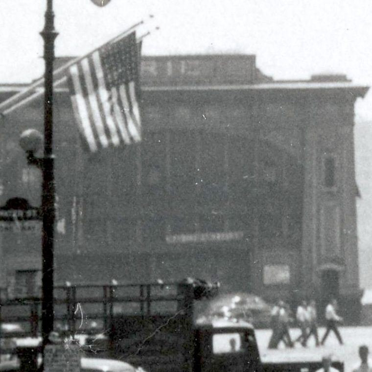
From Max Hubacher, June 8, 1950, “The famous S-curve near South Ferry on the Third Avenue Elevated, Manhattan, N.Y.”:

Unless you are obsessive about the history of rail in New York City – and if you are, let me know – you don’t think this is famous. More likely, if it weren’t for the words “South Ferry” in the title, you’d have no idea where this is. And if you know lower Manhattan, it’s even more confusing, because that treed area is much too small to be Battery Park, which is immediately adjacent to South Ferry. The trick to understanding what you’re looking at is to note that the S-curve of the tracks takes place over a big area of asphalt.
Unfortunately, most of the fire maps only show the elevated stations, not the tracks. Fortunately, the lines downtown didn’t change between the 1890s and their demolition in the 1950s, so I can use an older map that shows the lines. Here’s 1916:

Battery Park is on the far left and South Ferry is the lower left corner. The big yellow rectangle was the main ferry building – the 1909 Battery Maritime Building – serving Brooklyn. The unlabeled yellow building to its left is where the current Staten Island ferry terminal is. You can see the South Ferry elevated station, and there are track curves, bending to the right for the Second and Third Avenue els, bending to the left for the Sixth and Ninth Avenue els. But those are single curves, not double (S) curves.
If you look off to the right, about halfway between the top and bottom, in line with the “Part of Section 1” title, you see Hanover Square (which is a triangle) and the Hanover Square el station serving the Second and Third Avenue els. And just about halfway between that and the South Ferry station you see the S curve that allows the line to shift from Pearl Street to Front Street. The open space of Coenties Slip provided a good place for the elevated to make that curve when the line was built, opening in 1878. In 1884, the river end of the triangle was turned into Jeanette Park, the trees we see in the photo.
One last piece of corroboration. The low building on the far left of the photo is a pier. What we can see of the sign is “RIE.” If you look at the map, pier 7, rented by the Erie Railroad, is at the right location.

You must be logged in to post a comment.