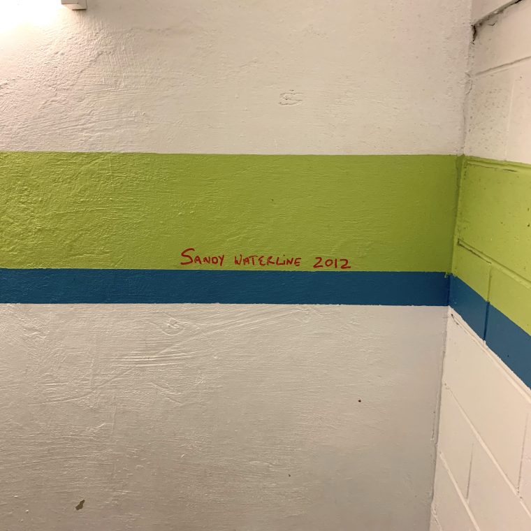

The photo above was taken in the stair of a school, between the cellar (the first level below grade) and the sub-cellar (the second level below grade). More accurately, the line representing the flood during Hurricane Sandy was 33 steps, or roughly 20 feet, below grade. Grade at this location (according to the topo map I found) is about 7 feet above sea level. That street elevation would have flooded on the east side of Manhattan, where the storm surge was highest, but wouldn’t necessarily have flooded on the west side.
Basically, the sub-cellar filled with water during the storm. This is a modern building with deep foundations (because it’s on poor soil near the Hudson River), so there was no overt damage to the structure. I assume (I never saw the building before Sandy) that all of the finishes in the sub-cellar level were replaced after the storm. The most likely damage here is slightly accelerated aging of the structure, which may never be detectable as something separate from ordinary wear and tear.
But…how many nearby buildings had flooded cellars? How many of them are not new construction? How many with masonry foundation walls and wood-pile supports? The Sandy flood waters were generally salty, so how much old brick was submerged in salt water and now has an increased level of damaging salt in its pores?
There is literally nothing to be done now about damage from Sandy. There are all sorts of plans, ranging from the scale of individual buildings to the scale of all of the city, to prevent damage from future storms. But how much damage was done by that one storm that will never be identified as such?