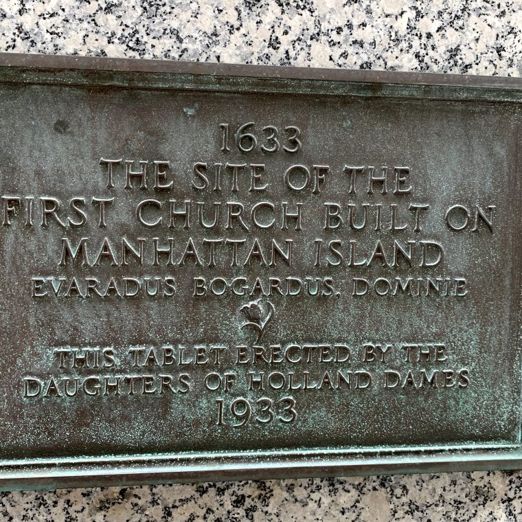
That plaque is on the wall of a 1960s building near our office, where it was apparently transplanted from the 1880s building previously on the site. The plaque faces Pearl Street, which was the East River waterfront in 1633, so the church must have been quite prominent to view for ships coming into to dock.
Unfortunately, the 1660 Castello Plan – the earliest map of the city – doesn’t seem to show the church, unless it looked exactly like the buildings adjacent to it. It should be on the narrow waterfront block left of the Broad Street canal. Maybe it’s the small building with a large piece of land, but there’s no way to be sure from this view.

Somehow, I feel cheated.
You must be logged in to post a comment.