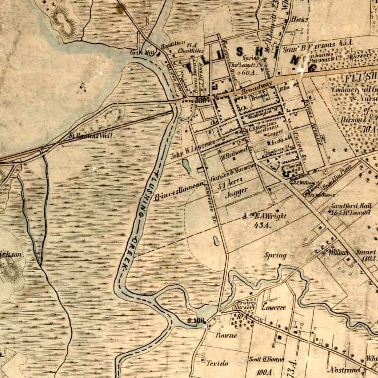

For some reason I have an 1852 map of Kings and Queens counties bookmarked. The small piece above is the town of Flushing as it appeared then, including the location of where I grew up, approximately where the letters “ndf” are in “Sandford Hall.” The railroad – an independent line later merged into the Long Island Railroad – hadn’t made it there yet. The salt marsh surrounding Flushing Creek wouldn’t be made into a park until the 1939-40 World’s Fair, and in 1852 it hadn’t yet been used as a garbage dump as memorialized in The Great Gatsby ‘s “valley of ashes.” The plant nurseries that were the town’s main business are visible.
Main Street was later extended south, as were Union Street and Bowne Avenue, renamed to Bowne Street. The diagonal branching off of Main was then the Jamaica Road, it’s now Kissena Boulevard; Long Lane was extended north and south as Parsons Boulevard; Broadway, Bridge Street, and the Flushing and Bayside Road are now parts of Northern Boulevard. Lawrence Street is now College Point Avenue and extended north and south. The street closest to its modern self is Sandford Avenue, later extended to the west.

