I’m going to spend this week reviewing a single 115-year-old issue of a magazine. Scientific American has for a long time been very much oriented towards science, with engineering topics appearing less frequently. In the nineteenth and early twentieth centuries it was more general, and often had more articles on engineering than pure science; for a while there was a specialty version called the “Architects and Builders” edition. So the idea of a special issue devoted entirely to the engineering of New York was not so odd.
The inclusion of those dates is no accident. Greater New York was created in 1898 by the city of New York (by then, Manhattan and the Bronx) annexing Brooklyn and Kings County, the western half of Queens county as it was then constituted, and Staten Island. Brooklyn was the real prize, increasing the total population of the combined city by some 60 percent and providing an enormous amount of industrial and port space to address the growing congestion in Manhattan. The issue of Scientific American published ten years later mostly addresses what had been done in that decade to physically tie the enlarged city together as well as what was planned or in progress.
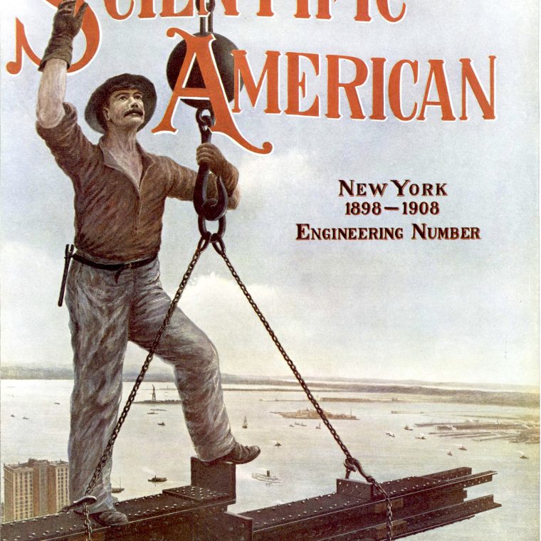
The cover, above, shows a steel-worker wearing the safety equipment of the era – gloves and street clothing – building a skyscraper. Given the view, this is likely taken from a photo of the construction of the Singer Building or the adjacent City Investing Building. The construction of skyscrapers, of course, did nothing to better consolidate the city, but it was not unrelated to that issue. The extraordinary growth of the white-collar business center downtown (followed after the magazine was published by a similar center in midtown), at a time when there was no such thing as office work from home, strained the transportation, water, sewage, and electric networks. So the cover picture shows part of the cause of the problems, not the solution.

The interior cover has a badly-distorted bird’s eye view of Manhattan and its surroundings, marked to show some of the work completed or planned. The four toll-free bridges over the East River are the most familiar, with the Queensboro labelled with its old name, the Blackwell’s Island Bridge. Blackwell’s Island is, in turn, the old name for what was renamed Welfare Island and then Roosevelt Island. The IRT subway provides the “Rapid Transit Tunnel” at the foot of Manhattan and the Lexington Avenue and (unlabeled) Seventh Avenue subways. The downtown PATH train is there under the familiar Hudson & Manhattan Railroad name; the uptown (Greenwich Village) PATH branch is called the New York and Jersey Railroad. Penn Station was under construction in 1908, and the tunnels under the Hudson and East Rivers are labelled as “P.R.R.” The Belmont tunnel was meant for streetcar service but eventually became the Manhattan extension of the elevated line in Queens now known as the 7 train. The Hell Gate Bridge, drawn as if it were to be three Brooklyn Bridges, is either a failed scheme or the line is shown wrong: as it opened in the 1910s, it allows rail lines coming form the northeast to get to Queens and then curve west to the Pennsylvania Railroad tunnel.
Despite the distortion, this view from a theoretical bird flying very high puts it all in perspective. A lot fo work had to be done. More tomorrow…


You must be logged in to post a comment.