
It’s a cliché to state that land is expensive in Manhattan because it’s an island surrounded by large rivers and therefore the supply is inherently limited. That cliché is also, to a large degree, only partially true, particularly in the past. Taxpayers exist because the land is worth holding on to but isn’t so valuable that it must be developed immediately. There is still, to this day, some industrial use in Manhattan, although in my lifetime it’s been squeezed to the margins. (The predecessor firm to Old Structures was in a loft building in Chelsea in the mid-1990s, and there were industrial tenants in the building with us. I know this because we could hear their machinery operating.) Even the financial district used to be surrounded, along the rivers, by a fringe of industry in cheap buildings…some of which are preserved at the South Street Seaport. And, of course, the construction of bridges and tunnels made cheaper land in Brooklyn, Queens, and New Jersey readily accessible by train and sometimes by car. (The Bronx, too, but usually with a longer trip.)
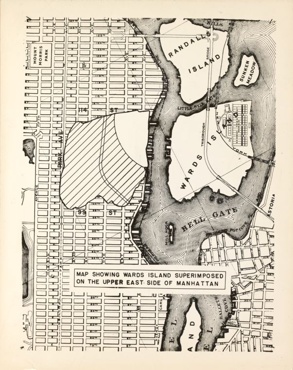
During the period of grand plans for remaking the city, roughly 1890 to 1940, planners had an obsession with adding land to Manhattan. This showed up, for example, in the bizarre plan to fill in half the harbor to create New Manhattan. There are echoes of that in this illustration from the 1937 “Report on the proposed development of Ward’s Island and the construction of a pedestrian bridge between the island and East 103rd Street, Manhattan,” which was prepared by the Triborough Bridge Authority long before it was subsumed into the MTA.

The bridge was built after World War II, opening in 1951, but its traffic has been limited. The idea was that people on the Upper East Side and in East Harlem could easily walk to the park that had been built on Ward’s Island in the East River, but the reality of it was that most people don’t walk long distances to go to parks. They go to neighborhood parks even if they’re not as nice; or they take the train or drive. But that bizarre map fascinates me. The point, I guess, is that the park on Ward’s Island is so big that it was equal in area to about a third of East Harlem, but it sure seems like “look at all this vacant land!”


You must be logged in to post a comment.