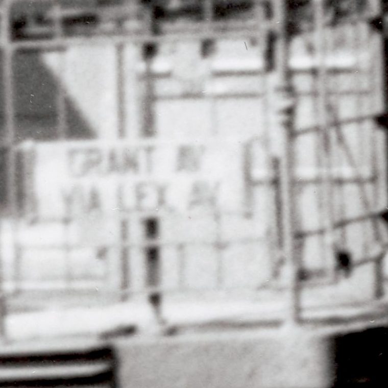

From Max Hubacher’s tour of elevated trains and streetcars, “Lexington Avenue El” from October 13, 1950:

If you’re reasonably familiar with NYC’s transit, that sounds very strange. The Lexington Avenue subway was constructed to replace the Third Avenue el. The clarification is simple: this is Brooklyn, not Manhattan, and we’re talking about a completely different street called “Lexington Avenue.” Subway maps are just about always distorted, but let’s start with one, a 1924 map of the Brooklyn-Manhattan Transit Corporation (BMT) lines:

This is a company-specific map and does not show the Interborough Rapid Transit (IRT) lines in Manhattan and the Bronx. It does show the Flushing line (here called the Corona Line because it ends in Corona, with the last three stations to Flushing shown dashed for “to be constructed.”) because that line was run jointly between the BMT company and the IRT. In 1924, IRT service went over the Queensborough bridge and then downtown on the Second Avenue el, or through the tunnel now used by all trains on the line to 42nd Street in Manhattan. Similarly, the Nassau Street loop in lower Manhattan was still in construction.
Service to eastern Brooklyn looks almost, but not quite, familiar. There’s a line on Manhattan’s 14th Street as far as Montrose Ave; the rest of what is now the L train route from Montrose to Broadway Junction is to be constructed; the route east from Broadway to Canarsie was accessed by the Broadway or Fulton els. The Broadway line looks about the same as now; the Fulton line route looks much like the IND subway that replaced it. The Myrtle Avenue line includes the route north of Broadway that is still in service as part of the M train as well as the service south of Broadway to downtown Brooklyn and then over the Brooklyn Bridge. And that’s where we get to the Lexington Avenue el: it’s a branch off the Myrtle Avenue el. Why was that branch needed? Let’s look at an undistorted map:

This is a modern subway map overlaid on the actual street grid (courtesy of Apple Maps), and shows the lines in their current colors. The medium-blue line is the IND Fulton Street subway, which replaced the BMT Fulton el; the purple line two blocks south of that is the Long Island Railroad’s branch to Atlantic Terminal. The Broadway line – the J train – is the brown line running from the center top to the lower right, and the modern Myrtle Avenue line – the M train – can be seen branching off in orange. The heavy dashed orange line is the portion of the Myrtle Avenue el that has been demolished and the heavy dashed pink line is the Lexington Avenue el as it existed in 1924. The light green line is the IND G train, which did not yet exist in 1924.
The two demolished el lines on Myrtle and Lexington provided rail service to a large swathe of Bed-Stuy and Clinton Hill. The G train replaces part of that service but badly, since the G is the Brooklyn-Queens “crosstown” and never enters Manhattan. You used to be able to get an el on Myrtle or Lexington to the Brooklyn Bridge station opposite City Hall, the G forces you to change. The busses that run in the area help but are not really a replacement.
Finally, the train in Hubacher’s picture has a sign mounted in front that gives its destination as “GRANT AV via LEX AV” Grant Avenue was a station on the Fulton el which can be seen on the BMT map just short of the Brooklyn/Queens border. The IND subway construction ended with the new Grant Ave station, and after that the trains go above ground on the old BMT elevated structure.

You must be logged in to post a comment.