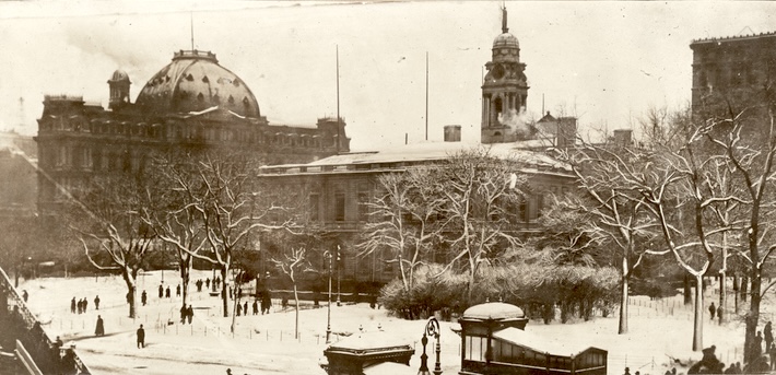
Here’s City Hall Park on a snowy day in 1907, not looking quite right:

We’re near the northeast corner of the (roughly) triangular park, looking more or less southwest. City Hall is in the center, but we’re looking at its back and east side, rather than its front. The big building with the curved mansard roof is the old General Post Office at the southern corner of the park but again we’re looking at its back. if the photo were clearer and the trees didn’t partially block the view, you’d be able to see the loading docks at the back of the post office. We can’t see the Tweed Courthouse because it’s out of frame to the right.
The tall building on the right appears to be the Postal Telegraph Building, looking much darker than its masonry actually is. The subway kiosks in the foreground – only three years old! – lead to the Brooklyn Bridge staton. The City Hall Station is literally right on the other side of City Hall, as the local IRT trains make a loop under the park, which explains why the abandonment of the City Hall station didn’t hurt subway ridership.
Finally, the stairway to nowhere on the left leads to the elevated terminal station at the end of the Brooklyn Bridge. In other words, the IRT subway station wasn’t named “Brooklyn Bridge” because it’s near the bridge, it was named that because it was a transfer station to the el at the bridge.

You must be logged in to post a comment.