

Annexing the Bronx made perfect sense from the perspective of nineteenth-century New Yorkers. The city of New York was growing northward up Manhattan island and, while it had not yet filled all of the space, the end of that form of expansion was in sight. The semi-rival city of Brooklyn had far more space to expand and, prior to the completion of the Brooklyn Bridge in 1883, discussion of New York and Brooklyn being something other than rivals was rare. The area we call the Bronx, on the other hand, was the semi-rural south end of Westchester County, with a handful of small towns and some farms. New York annexed the portion west of the Bronx River in 1874, and the part east of the river in 1895. By the latter date, the work of annexing Kings County (and therefore Brooklyn) and the western half of Queens County (what is now Queens, with the eastern half eventually becoming Nassau County) was in motion.
The area south of 180th Street and west of the Bronx River used to be, in general terms, called the West Bronx, and was subdivided into smaller neighborhoods like Morrisania and Tremont. It was always largely residential, with some industry at the fringes; it became famous in the 1970s as a symbol of urban decay and disinvestment. It also accidentally picked up a new name: when President Carter came to visit to promise federal help for revitalization, someone in his office -presumably not from the Bronx – looked at a map, saw that the area was in the southern part of the borough, and dubbed it the South Bronx in a press release. When I was working on housing rehabs there in the early 1990s, there were still entire blocks, which had once been full of apartment houses, that contained nothing but grass taller than me.
The earliest revitalization, in the 1980s, came in the form of new rowhouses. More recently new apartment buildings have been constructed, but in recent years the density in some portions of the area now exceeds the previous (1970) peak. The cluster of large high rises at the very southern tip of the Bronx is the most visible sign of the new development, but I was on the 5 train yesterday and was struck by how many new buildings are visible from the elevated portion of the line from the Hub (Third Avenue and 149th Street) past Morrisania and West Farms, up to Bronx Park East.
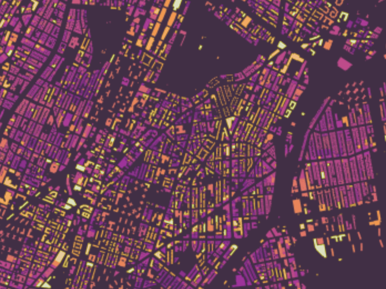
You don’t have to trust my memory and rambling: looking at the US census, the population of the Bronx hit a 1,472,000 in 1970, declined to 1,169,000 in 1980, and was back to 1,473,000 in 2020. Or graphically, look for the lightest shades of yellow (indicating the most recent build date) in Kieran Healey’s map of “New York City buildings by Decade of Construction“:
The cycle of construction, decay, and new construction has taken a little over a hundred years. Here’s a view of an apartment house under construction on Lydig Avenue in 1928, with the IRT subway – now the 5 train – elevated in the background:

You must be logged in to post a comment.